


May 30, 2026
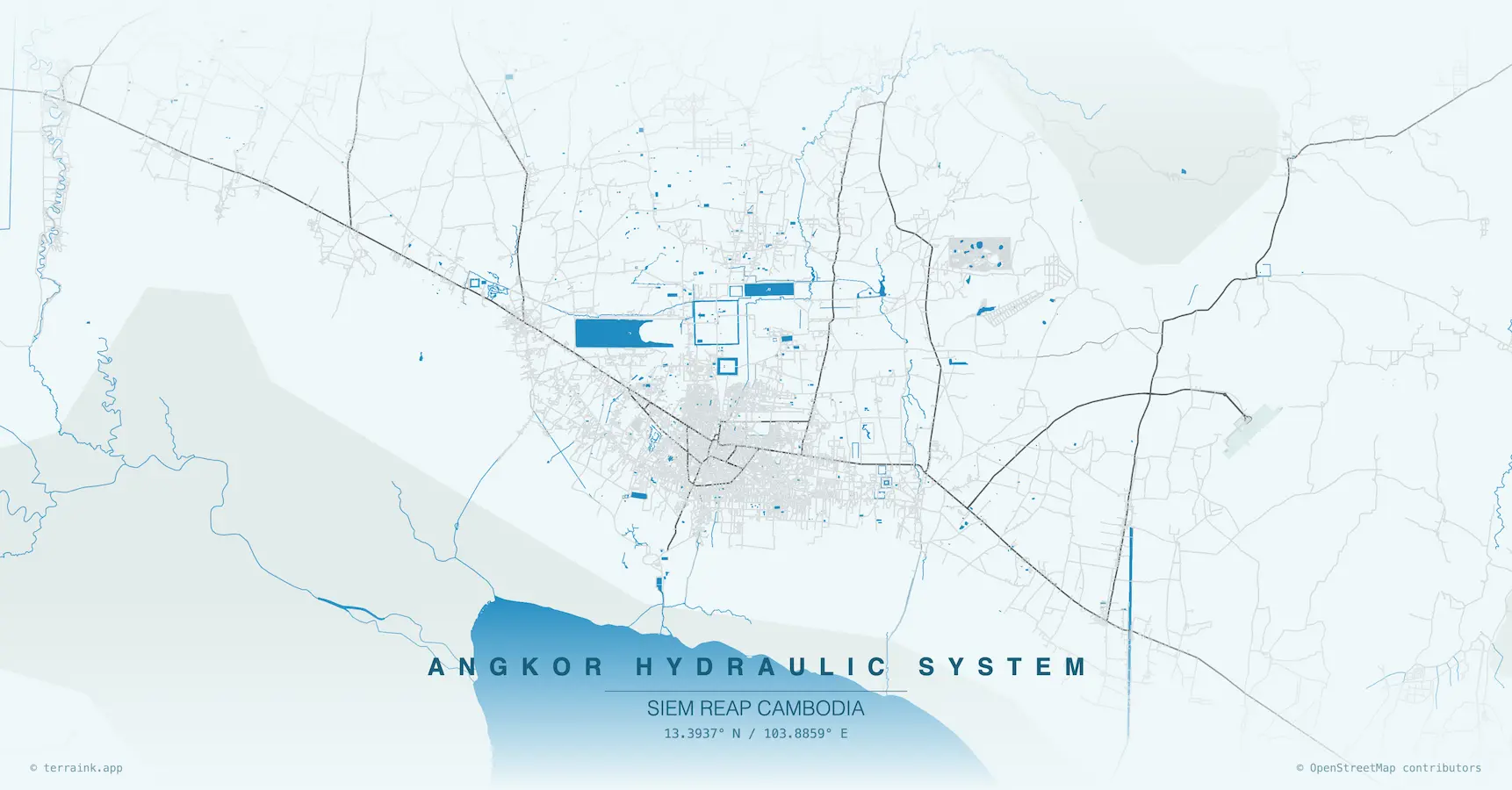
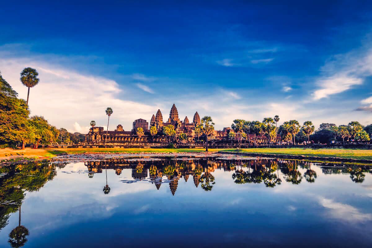
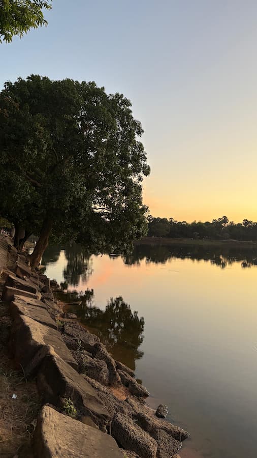
Greater Angkor was built on water. Across roughly 1,000 square kilometers, the Khmer engineers cut canals, raised embankments, dug reservoirs the size of small cities, and wrapped every major temple in a moat. Angkor Wat alone is ringed by 5.5 kilometers of water that is 190 meters wide and still holds today (UNESCO). The water was defense, foundation, irrigation, and cosmic symbol at the same time. Without it, none of the temples we visit would be standing.
I grew up inside Angkor Wat. The pagoda where my grandfather served as Grand Abbot sits behind the food vendors, on the left when you face the temple. As a child, I watched the monks draw water from the moat every morning. The moat was not decoration for us. It was the water supply, the flood buffer, and the cosmic ocean around Mount Meru all at once. Cambodians still know the Siem Reap River the way the empire knew it. This guide is how we explain that system, in plain English, to guests who want to understand why Angkor is where it is.
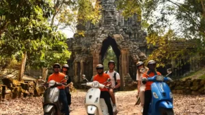
If you are planning a first visit, start with our complete Angkor Wat guide, then come back here for the water story. Both pair naturally with our electric mountain bike tours, because the barays and canals are easiest to feel from a bike on a quiet trail.
KEY TAKEAWAYS
- Scale: Greater Angkor covered roughly 1,000 km², one of the largest pre-industrial hydraulic systems ever built (Evans et al., PNAS 2007).
- Four great barays: Indratataka, East Baray, West Baray, Jayatataka. West Baray still holds water (8 km x 2.1 km).
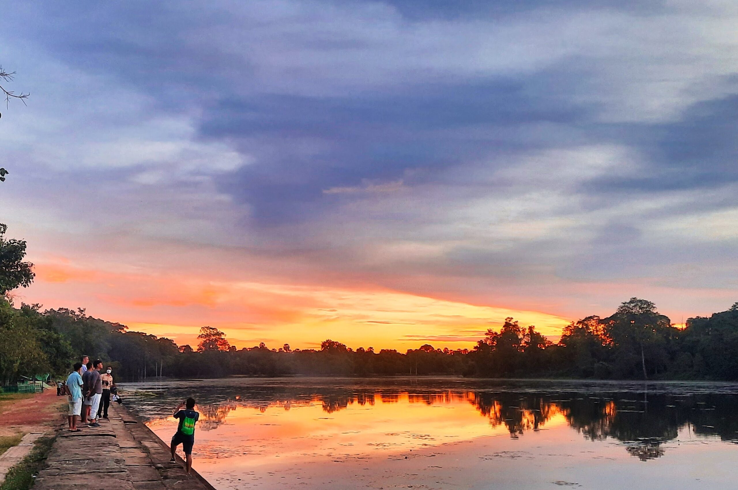
- The moat: Angkor Wat’s moat is 5.5 km around and 190 m wide. It is structural, not decorative.
- Source: Water came from the Kulen mountains, 40 km northeast, carried by canals and the Siem Reap River.
- Decline: Severe 14th-century droughts and sediment buildup broke the system before Ayutthaya arrived.
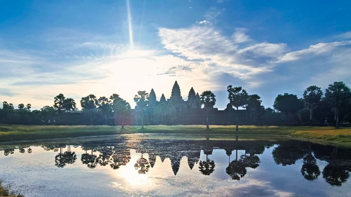
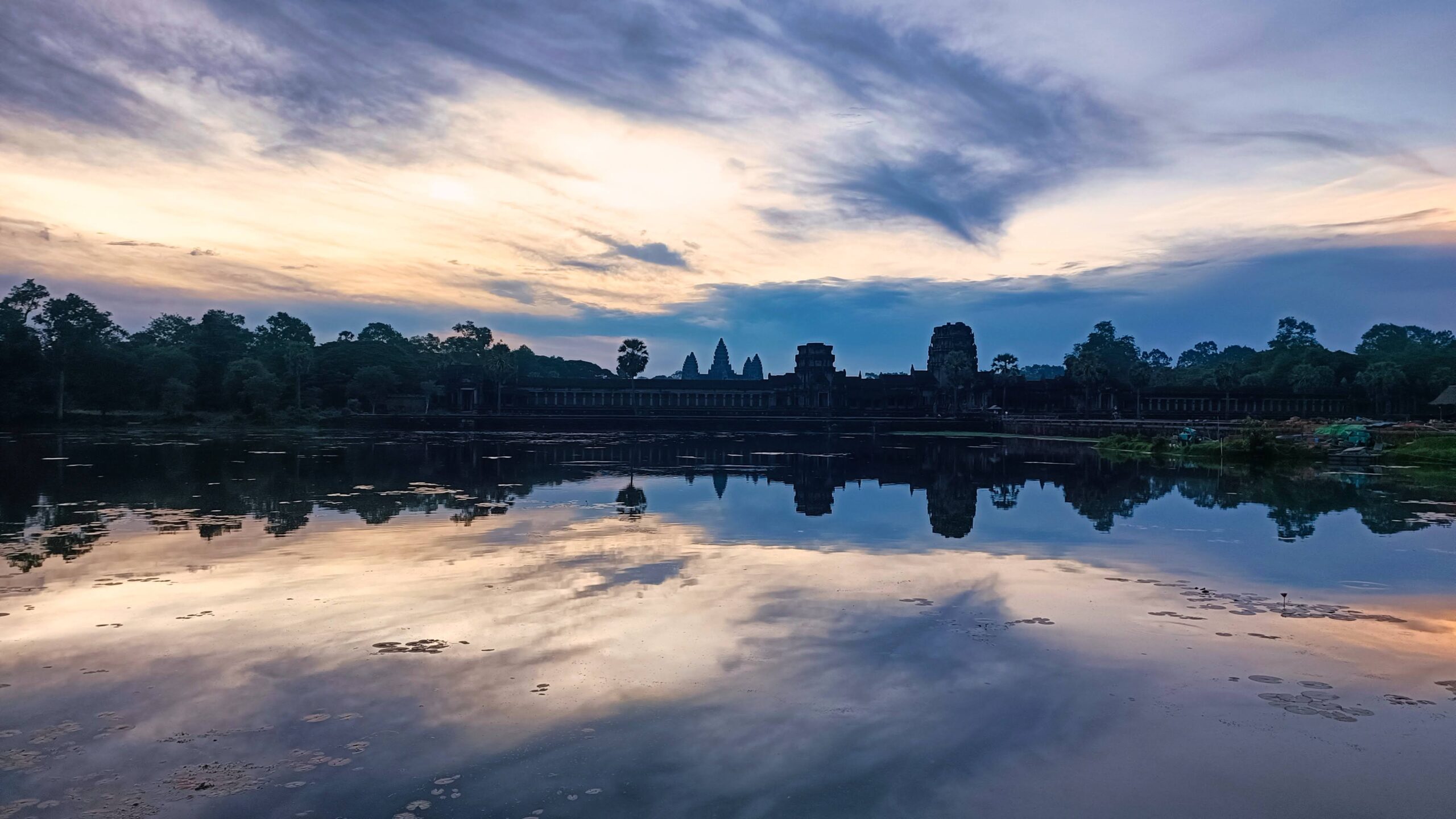
The 190-meter-wide moat at Angkor Wat at dawn.
The northern reflecting pond, fed from the moat.
What Is the Angkor Water System?
The Angkor water system is the network of reservoirs, canals, moats, embankments, and sluices built by the Khmer Empire between the 9th and 13th centuries to move water from the Kulen mountains across the floodplain below. Satellite and LiDAR surveys by the UNESCO Angkor World Heritage Site and the Greater Angkor Project have mapped a hydraulic footprint of roughly 1,000 square kilometers. That makes Angkor one of the largest pre-industrial urban complexes ever built.
Four layers did the work. Reservoirs called barays stored monsoon water. Canals moved it between reservoirs and toward the temples. Moats wrapped each major monument. Smaller ponds called srah served individual shrines, royal baths, and pagodas. Every piece was connected. When one part of the network failed, the rest felt it.
Why Did the Khmer Empire Build So Much Water Infrastructure?
Two answers, both true. The practical answer: Cambodia has a monsoon climate. Six months of heavy rain, six months of near-drought. Siem Reap receives about 1,400 mm of rain per year, almost all of it between May and October (Climate-Data.org). A city of perhaps 750,000 to one million people, which is what Greater Angkor held at its peak, could not survive that seasonality without storing water for the dry months and draining it during the floods.
The spiritual answer: water is the cosmic ocean. In Hindu and Buddhist cosmology, Mount Meru sits at the center of the universe, surrounded by a great ocean. Every Khmer temple is a model of Mount Meru in stone. The moat around it represents the cosmic ocean. When you stand on the causeway crossing the Angkor Wat moat, you are crossing from the mortal world into the world of the gods. That idea is older than the dynasty itself. The engineers made it literal.
What Does the Moat at Angkor Wat Mean?
Angkor Wat’s moat is both the cosmic ocean and the foundation of the temple. It stretches 1.5 km on each side, a perimeter of roughly 5.5 km, and measures 190 meters across. Suryavarman II ordered it dug between 1113 and 1150 CE as part of the temple’s construction (UNESCO). It has never been fully dry since.
The structural role is less poetic but more important. Angkor Wat sits on sandy soil. Sandstone towers that heavy need stable ground. The moat keeps the water table around the temple constant year-round. In the dry season it slows evaporation from the soil below the foundations. In the wet season it catches surplus water that would otherwise saturate the ground and destabilize the stones. The temples that have collapsed at Angkor, Ta Keo for example, are almost all temples without an effective water ring.
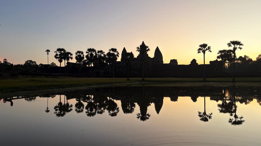
Angkor Wat’s silhouette in the southern moat at dawn.
The five towers framed by the water ring that stabilizes them.
MY PICK
Walk the moat the long way. Most visitors cross the western causeway and look no further. If you leave Angkor Wat through the eastern gate and follow the moat clockwise, you reach the quiet south side within 10 minutes. Almost no one is there. The temple reflects in a perfect band of water. On our sunrise e-MTB experience, this is where we stop for the second-light photo, after the crowds have cleared.
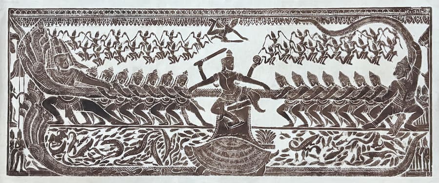
The Churning of the Sea of Milk: Cosmic Water Carved in Stone
Inside Angkor Wat’s east gallery, a 49-meter bas-relief panel tells the Hindu creation story of the Churning of the Sea of Milk. Gods and demons pull a naga serpent back and forth, wrapped around Mount Mandara, to churn the cosmic ocean and release the nectar of immortality. It is one of the most famous bas-reliefs in the world and the most literal image of water in the entire temple.
The panel matters because it shows what the moat outside means. The water around Angkor Wat is the same ocean the gods are churning inside the bas-relief. The temple is the mountain. The causeway is the naga bridge connecting the two. Nothing about Angkor’s water is accidental. It is all one story, one scale model, one continuous idea. For the full reading of this panel and the other great carvings, see our guide to Angkor Wat’s bas-reliefs.
How Did the Khmer Engineers Control the Monsoon?
The system had four components. Each one has a specific job. Together they held the water budget of the empire.
Baray
Giant reservoir
Rectangular, earth-embanked, holds monsoon water for the dry season. Four great barays in total.
Canal
Delivery channel
Moves water between barays, from the Kulen source, and out to the temples and ricefields.
Moat
Temple ring
Wraps each major temple. Stabilizes the foundation, manages the water table, and symbolizes the cosmic ocean.
Srah
Sacred pond
Smaller pools at pagodas, royal baths, and secondary shrines. Srah Srang is the most famous.
The trick was the slope. Greater Angkor sits on a very gentle gradient from the Kulen mountains in the northeast down toward the Tonle Sap lake in the southwest. The engineers used that slope to move water by gravity alone, through canals cut with a precision that took Western researchers decades to map. There was no pumping, no wheel-lifting, no steam. Gravity plus earth plus stone.
The Four Great Barays of Angkor
Four enormous reservoirs sit inside the Angkor zone. Each was built by a different king and dedicated in a different century. Together they stored the water that sustained the empire.
| Baray | Builder | Century | Size | Today |
|---|---|---|---|---|
| Indratataka | Indravarman I | Late 9th | 3.8 km x 0.8 km | Partly filled, Roluos group |
| East Baray | Yasovarman I | Late 9th | 7.5 km x 1.8 km | Dry, ricefields inside |
| West Baray | Suryavarman I | 11th | 8 km x 2.1 km | Holds water year-round |
| Jayatataka | Jayavarman VII | Late 12th | 3.7 km x 0.9 km | Restored, near Preah Khan |
Dimensions and dating: APSARA National Authority and UNESCO Angkor.
The West Baray is the one most visitors miss. It is the only great baray that still holds water year-round, and it is roughly twice the surface area of New York’s Central Park reservoir. A small island in the middle, Western Mebon, once held a bronze statue of Vishnu now in the National Museum in Phnom Penh. On dry afternoons, families from Siem Reap come to swim off the southern embankment. It is one of the few places inside the park where you see Cambodians using the old infrastructure the same way their ancestors did. The West Baray is also one of the stops on our Siem Reap countryside e-MTB experience, reached by quiet back roads through the villages that still depend on it.
Srah Srang, the royal bath, at sunset on the Small Circuit.
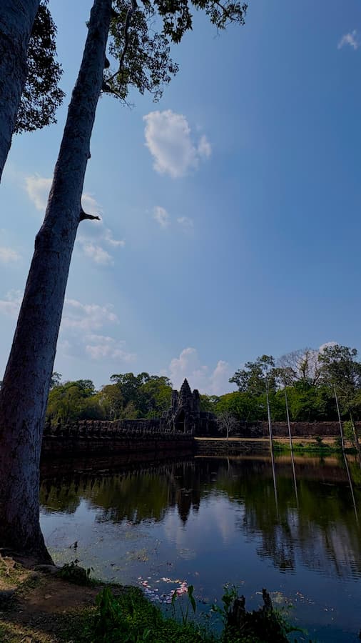
The moat of Angkor Thom, still wrapping the ancient city.
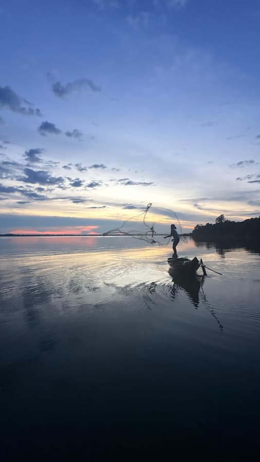
Nets still go out on the West Baray at dusk, a thousand years on.
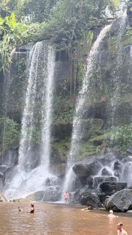
Phnom Kulen: The Sacred Source
All of it starts at Phnom Kulen, the sandstone plateau 40 km northeast of Siem Reap. The Kulen is the source of the Siem Reap River and the sacred mountain where Jayavarman II declared the founding of the Khmer Empire in 802 CE. Water from its rainfall and streams is what the entire Angkor network captures and redirects. Without Kulen, no barays, no moats, no Angkor Wat.
The most visible proof of that relationship is at Kbal Spean, the carved riverbed the Khmer called the River of 1,000 Lingas. The riverbed was carved with hundreds of lingas (phallic Shiva symbols) and Hindu deities so that the water flowing downstream, toward the temples, would be blessed as it went. The water that fills the Angkor Wat moat was ritually sanctified before it ever arrived. That is how seriously this culture took water.
Phnom Kulen, the source feeding every moat at Angkor.
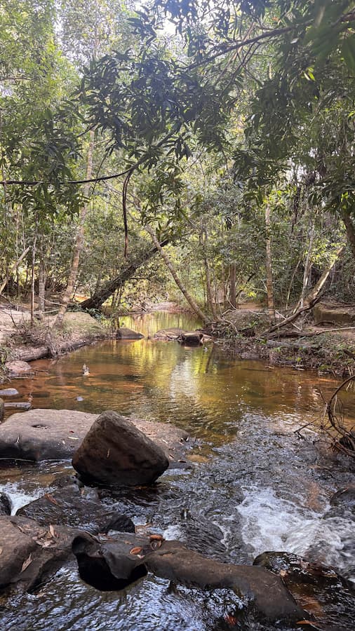
Forest stream at Kbal Spean, the River of 1,000 Lingas.
MY PICK
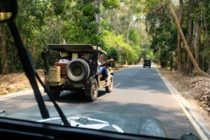
Kulen deserves a full day. The waterfalls, the reclining Buddha at Preah Ang Thom, Kbal Spean, and the older pre-Angkorian sites around the plateau do not fit into a morning stop. Our vintage Jeep experience or a dedicated Secret Trails e-MTB ride are both built to take guests into the Kulen the way the old pilgrimage routes ran.
Did a Water System Collapse Really End Angkor?
For a long time the textbook answer was that the Thai kingdom of Ayutthaya sacked Angkor in 1431 and the city emptied out. That story is not wrong, but it is incomplete. Tree-ring data and sediment cores now show that the real trouble started a century earlier and came from the sky, not the Thai army.
A tree-ring reconstruction published in PNAS in 2010 by Buckley et al. identified two severe decades-long droughts over the late 14th and early 15th centuries, separated by periods of extreme monsoon flooding. Sediment cores from the West Baray and canal intersections, analyzed by the Greater Angkor Project, show silt buildup and spillway ruptures that match exactly those climate swings. The system could handle normal monsoon variability. It could not handle droughts that were followed by floods that overwhelmed infrastructure that had already been weakened by neglect.
The honest version: Angkor declined because its water engineering could not keep up with climate shocks, and a weakened capital was then politically vulnerable to Ayutthaya. The Thai sacking was the last chapter, not the first. The bigger lesson is that Angkor’s rise and fall were both written in water.
Can You Still See the Ancient Water System Today?
Yes, and more of it than most guidebooks suggest. The moats, the West Baray, Srah Srang, the Jayatataka near Preah Khan, and Kbal Spean are all visitable today. Here is what you can realistically fit into an Angkor trip, depending on how the itinerary is built.
Small Circuit day
Angkor Wat moat + Srah Srang
Included in any small-circuit itinerary. The eastern moat and Srah Srang are already on the loop, no detour needed.
Grand Circuit day
Jayatataka + Preah Khan + East Baray
Add at the start or end of the loop. The Jayatataka embankment is the easiest full-baray view on the Grand Circuit. Preah Khan faces it directly across the water.
Full-day Kulen
Kbal Spean + waterfalls + lingas
Half-day minimum, full-day ideal. Kbal Spean is a 1.5 km forest walk in. Pair with the Kulen waterfalls and Banteay Srei for a full day.
Water at Angkor Today: What Cambodians Still Do
The water system is not a ruin. It is still used. At the Southern Angkor Pagoda where I grew up, the monks draw water from the moat for morning ablutions. During Cambodian New Year in April, whole families come to the moats of Angkor Wat and Angkor Thom to pour blessed water on Buddha statues and on each other. The festival of Bon Om Touk in November celebrates the reversal of the Tonle Sap river, which happens every year when the monsoon floods push the river backwards. The whole country is wired to water.
Fishermen still cast nets in the West Baray. Farmers still take irrigation water from the old canals. Children swim in Srah Srang on hot afternoons. The infrastructure that fed the empire now feeds a small town, and it does it quietly, as if nothing changed. If you stay long enough to see these rhythms, Angkor stops being a monument and becomes a living city again.
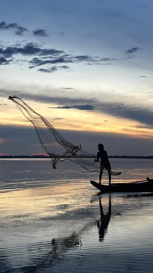
Nets still go out on the West Baray at sunset.
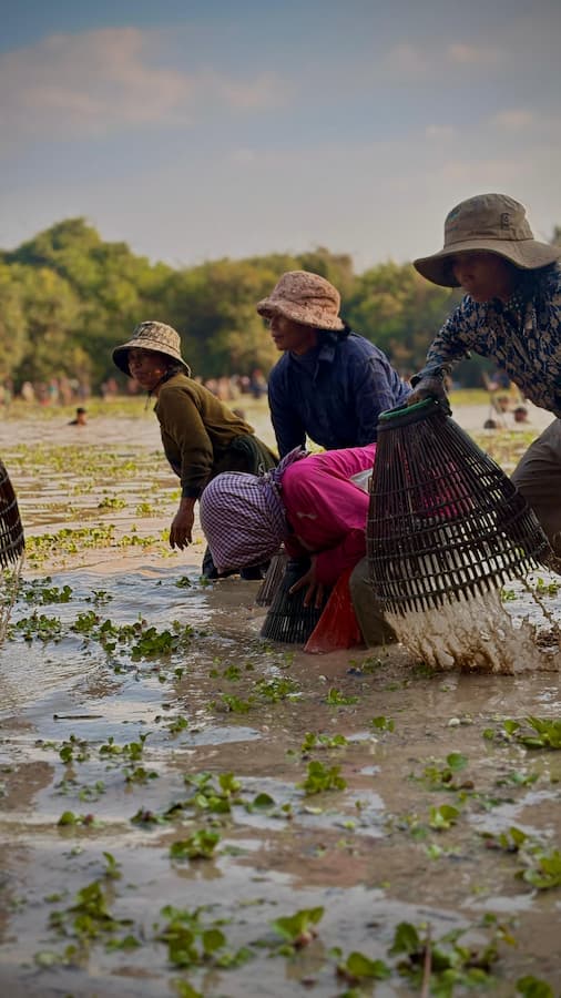
Traditional bamboo traps in a flooded field near Siem Reap.
Frequently Asked Questions
What is the Angkor water system?
The Angkor water system is the network of reservoirs (barays), canals, moats, and sacred ponds (srah) built by the Khmer Empire between the 9th and 13th centuries. It covered roughly 1,000 square kilometers and moved water from the Phnom Kulen mountains across the Angkor plain to supply the city, irrigate ricefields, and stabilize the temple foundations (UNESCO).
Why does Angkor Wat have a moat?
The moat does two jobs. Symbolically, it represents the cosmic ocean surrounding Mount Meru, the mythological center of the universe in Hindu and Buddhist cosmology. Practically, it stabilizes the sandy soil beneath the temple by keeping the water table constant year-round. Without the moat, Angkor Wat would not still be standing.
How big is the moat at Angkor Wat?
Angkor Wat’s moat is 1.5 km on each side, with a total perimeter of roughly 5.5 km, and it is 190 meters wide. The rectangular shape encloses the entire temple complex and its outer walls.
What are the barays of Angkor?
The barays are the four great artificial reservoirs of Angkor: Indratataka (late 9th century), East Baray (late 9th century), West Baray (11th century), and Jayatataka (late 12th century). They stored monsoon rainwater for the dry season and supplied the canal network that fed the temples and ricefields.
Is the West Baray still filled with water?
Yes. The West Baray (8 km by 2.1 km) is the only one of the four great barays that still holds water year-round. Families from Siem Reap swim off its southern embankment, and a small island in the middle holds the Western Mebon ruin.
What does water symbolize at Angkor Wat?
Water at Angkor represents the cosmic ocean that surrounds Mount Meru in Hindu cosmology. The temple itself is a scale model of Meru. The moat is the ocean. The causeway is the naga bridge connecting the mortal world to the divine. The bas-relief of the Churning of the Sea of Milk inside the temple makes the same idea literal in stone.
Did a water system collapse end the Khmer Empire?
It was a major factor. Tree-ring data in PNAS (Buckley et al. 2010) shows that severe 14th and 15th century droughts followed by extreme monsoons overwhelmed infrastructure that was already weakened. The Greater Angkor Project has mapped silt buildup and ruptured spillways in the network that match those climate swings. The Thai sacking of Angkor in 1431 was the last chapter, not the first cause.
Where did the water at Angkor come from?
From Phnom Kulen, the sandstone plateau 40 km northeast of Siem Reap. Rain falling on the Kulen feeds the Siem Reap River and the Stung Puok, which were captured by Khmer canals and directed across the gentle slope down to the Angkor plain. At Kbal Spean on the Kulen, the Khmer carved the riverbed with hundreds of lingas to bless the water as it flowed toward the temples.
Can you visit the Angkor water system today?
Yes. The moat at Angkor Wat, Srah Srang on the Small Circuit, the West Baray (still filled), and the Jayatataka near Preah Khan are all easy visits inside the park. Kbal Spean at the source is a half-day trip on the Kulen. Our e-MTB experiences and Jeep tours are both routed to see the hydraulic sites in context, not just the temples above them.